Sparrovale, Boundary & Batten Road Charlemont
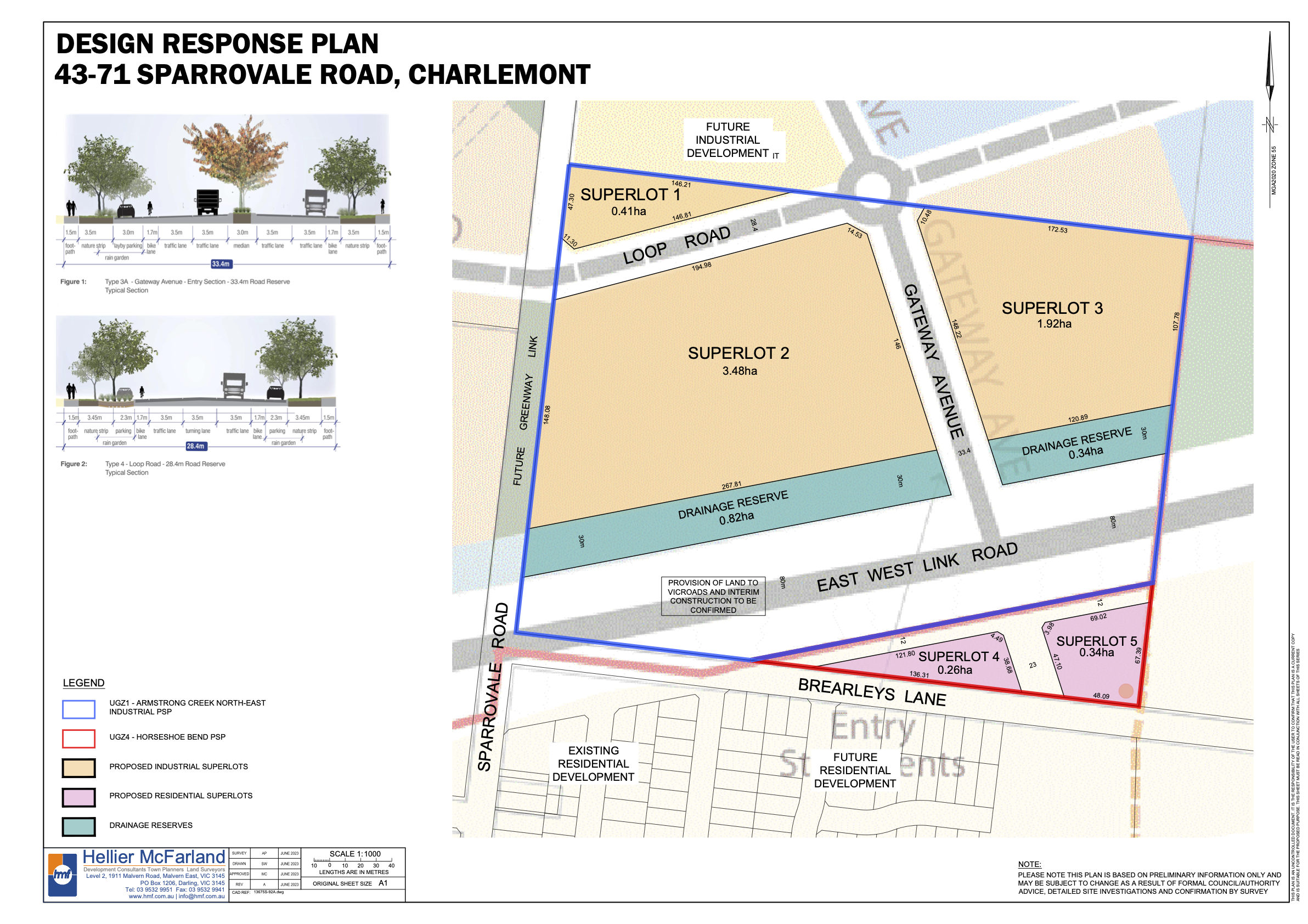
43-71 Sparrovale Rd, Charlemont
The site sits within the ARMSTRONG CREEK NORTH EAST INDUSTRIAL PRECINCT PRECINCT STRUCTURE PLAN and the ARMSTRONG CREEK HORSESHOE BEND PRECINCT STRUCTURE PLAN. The site consists of a proposed mix of Industrial and Residential Land uses.
Gross land area = 12.21 hectares.
Net Developable area = 8.03 hectares
GRV $36.5M.
Boundary and Batten Charlemont
Permit approved development of 370 Lots with Active Open Space (sporting fields) and a Conservation Reserve.
Gross land area = 18.77 hectares.
Net Developable area = 17.363 hectares
GRV $136.5M as confirmed by PUNVEC.